Wednesday, September 2, 2026
INFRASTRUCTURE• REGIONAL REPORT

MTA Advances Staten Island North Shore Bus Rapid Transit Corridor Reclaiming Abandoned Rail Right-of-Way to St. George Terminal

Transit officials and City Hall finalize capital engineering milestones for the 8-mile dedicated transitway along the Kill Van Kull, connecting Arlington to St. George Ferry in under 28 minutes.
By NY District News Staff•Staten Island, New York
November 8, 2026|8 min read
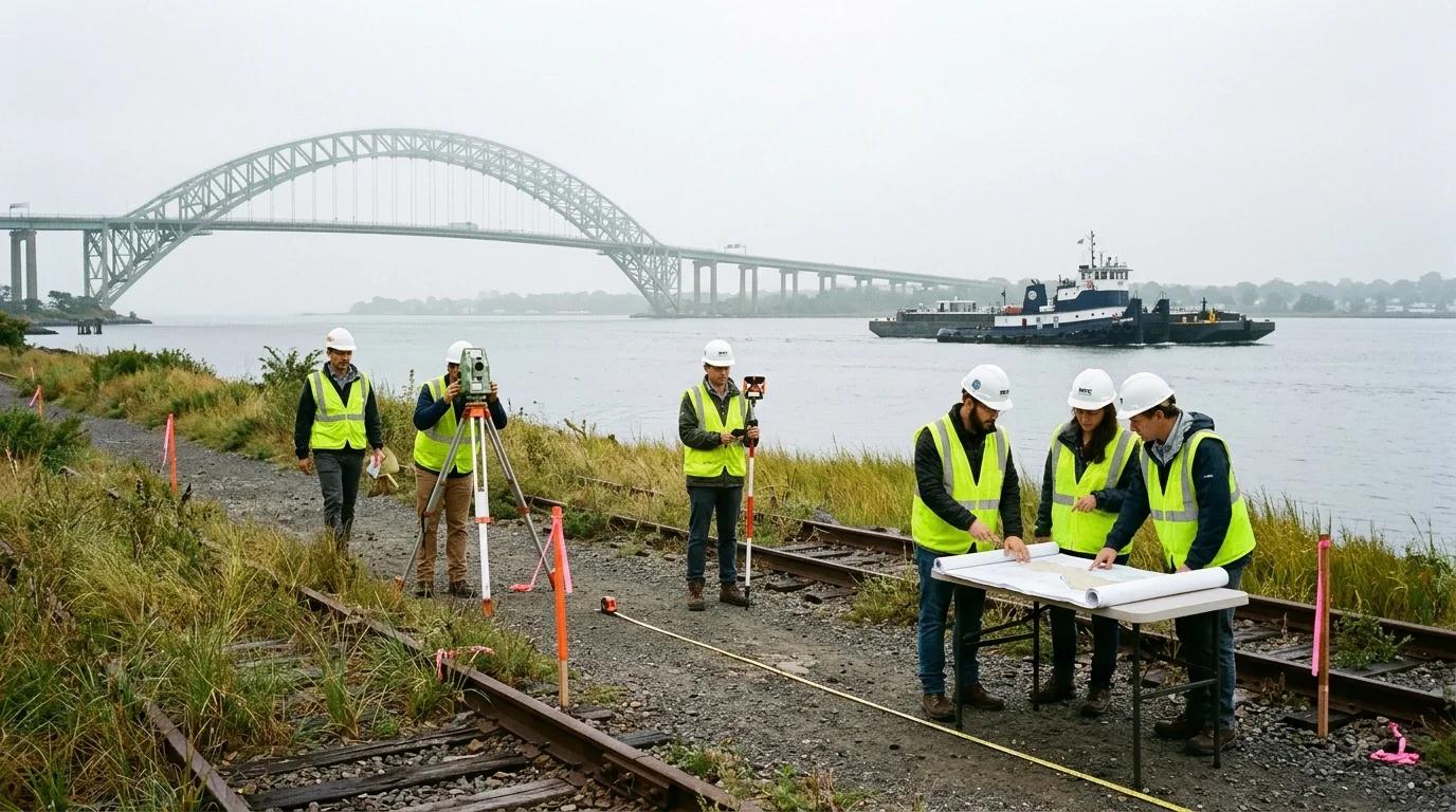
Civil transit engineers and survey teams inspect the historic North Shore rail right-of-way along the Kill Van Kull waterfront on Staten Island, preparing the corridor for dedicated bus rapid transit guideways.

The historic Staten Island Railway North Shore right-of-way along Richmond Terrace. The MTA and city partners are transforming 4.8 miles of dormant coastal corridor into an exclusive zero-emission Bus Rapid Transit guideway linking Arlington to St. George Terminal.

NY DISTRICT NEWS

KEY FINDINGS

  • •MTA and NYCEDC finalize civil engineering designs and capital clearances for the 8-mile Staten Island North Shore Bus Rapid Transit corridor.
  • •Project reclaims 4.8 miles of abandoned Staten Island Railway right-of-way along the Kill Van Kull into an exclusive zero-emission transitway.
  • •Commute times between Arlington/West Shore Plaza and St. George Ferry Terminal slashed from over 60 minutes to approximately 28 minutes.
  • •Includes 3.2 miles of dedicated median bus lanes with automated camera enforcement and transit signal priority (TSP).
  • •Features climate-resilient elevated guideways, living coastal bulkheads, and integrated waterfront esplanade connections for pedestrians and cyclists.
WHY THIS MATTERS

The North Shore BRT resolves generations of transit isolation across Northern Staten Island, reclaiming historic rail infrastructure to deliver rapid, zero-emission connections to the St. George Ferry while safeguarding the coastal waterfront against sea-level rise.

STATEN ISLAND — The Metropolitan Transportation Authority (MTA), in coordination with the New York City Economic Development Corporation (NYCEDC) and the New York City Department of Transportation (NYC DOT), has advanced comprehensive civil engineering plans and capital funding agreements for the long-awaited Staten Island North Shore Bus Rapid Transit (BRT) corridor.

The 8-mile rapid transit project represents the most consequential public transit capital investment on Staten Island in more than four decades. Designed to dismantle chronic vehicular congestion along Richmond Terrace, the express corridor delivers high-capacity, frequent mass transit across the borough's densely settled northern waterfront.
Central to the corridor's design is the historic adaptive reuse of 4.8 miles of the former Staten Island Railway (SIR) North Shore Branch right-of-way. Operating directly adjacent to the Kill Van Kull tidal waterway, the grade-separated rail corridor served commuter passenger trains until 1953. For more than seven decades, the tracks remained dormant, overgrown with wild flora and threading through historic maritime industrial properties.
Under the certified capital framework, contractors will clear, regrade, and structurally reinforce the coastal railbed, constructing a continuous two-lane, dedicated transit guideway engineered exclusively for zero-emission electric articulated buses. The project integrates an additional 3.2 miles of dedicated street-running median transit lanes along Richmond Terrace and South Avenue, protected by automated camera enforcement and transit signal priority (TSP) systems.
When passenger operations begin, the express transitway will cut peak travel times between West Shore Plaza and the St. George Ferry Terminal from over an hour on heavily gridlocked local avenues down to approximately 28 minutes, offering seamless transfers to the Staten Island Ferry and the operational Staten Island Railway.
“For seventy years, the dormant North Shore rail line served as a visual reminder of Staten Island's transit inequities,” stated Staten Island Borough President Vito Fossella. “By reclaiming this historic coastal corridor for a state-of-the-art, zero-emission rapid transitway, we are finally connecting working families across Arlington, Port Richmond, and New Brighton directly to the Manhattan ferry without leaving them trapped in Richmond Terrace traffic.”
The engineering specifications place a paramount focus on climate resiliency. Given the corridor's proximity to the tidal strait, engineers have designed elevated ballast foundations, permeable drainage swales, and living shoreline bulkheads capable of withstanding 100-year coastal flood surges and accelerating sea-level rise.
Beyond rapid transit platforms featuring off-board fare collection and real-time transit telemetry, the capital initiative partners with NYC Parks and community greenway advocates to build concurrent segments of the North Shore Waterfront Esplanade. The combined corridor will introduce continuous, protected public walkways and bike paths along previously inaccessible shoreline.
MTA Construction & Development officials confirmed that initial site preparation, vegetation clearing, and subterranean utility relocations are slated to launch in early 2027, with full commercial service targeted for late 2029.
NY

By NY District News Staff

NY District News reporters cover local government, business, consumer issues, tax fairness, and public accountability across New York.

Share Record:
XFB

Know More About This Story?

If you have documents, records, correspondence, photographs or first-hand information related to this investigation, NY District News wants to hear from you.
CONTINUE READING: MORE FROM NY DISTRICT NEWS

Circular Loop Navigation
THE DISTRICT BRIEF

Serious reporting. Right in your inbox.

Investigations, document dumps, and local accountability stories. No visual noise. Just New York journalism that matters.

Weekly accountability reports. Never shared. Unsubscribe anytime.